Reviewed by HootRated editorial · Last updated
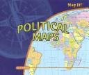
Reading political maps
Ian F. Mahaney

Reading political maps
Age Rating, Reading Level & Content Guide
by Ian F. Mahaney
The text is written at a 5th grade reading level, the subject matter is intended for younger children (ages 5–8), and the content is gentle with no concerning themes.
We may earn a commission from these links. Bookshop.org supports independent bookstores with every purchase.
About This Book
Discover the secrets behind political maps and learn how to find countries, states, and cities with ease. Explore colorful maps that show boundaries and places, making geography fun and simple to understand. Perfect for young explorers eager to know more about the world around them!
Themes
Quick Assessment
This is a Level 5-6 book with gentle content intensity. No notable content concerns flagged. Written for readers ages 5-8.
Why we rated Reading political maps 10C
Reading political maps is written at a Level 5-6 reading level across 34 pages (approximately 1,397 words). Strong independent readers around grade 6.1 can typically handle this book on their own; with parent or teacher support, Reading political maps works for readers up to grade 7.1.
Read aloud, Reading political maps takes about 9 minutes, which fits within a single read-aloud session.
We rate Reading political maps as 10C ("Clear") because the content sits in the "Gentle" range — no conflict beyond everyday childhood experiences. Across our four dimensions (emotional, physical, social, thematic) the book reads as evenly gentle; no single dimension stands out as a concern.
No specific content flags were raised by community reviewers, which is consistent with the gentle intensity score.
Thematically, Reading political maps weaves together science & nature and educational.
Good fit for
- ✓ Children in the Ages 5-8 range — the maturity and attention span match the story's pacing.
- ✓ Reluctant readers who need fast-paced, hook-heavy stories to stay engaged.
- ✓ Kids drawn to stories about science & nature, educational.
- ✓ Readers who fall hard for one book and want a long series to live in — there are 3 more books in the Map It!; PowerKids Press series.
- ✓ Curious kids who prefer real-world topics over made-up stories.
Maybe not for
- ! Readers whose emotional readiness lags behind their decoding skills — this book's intensity outruns its reading level, a classic "gifted kid" mismatch.
For Parents
Content Intensity
10C — ClearNo conflict beyond everyday childhood experiences. Safe for sensitive readers.
Was our "Gentle" content intensity rating accurate for this book?
Reading Insights
Hook Factor
8/10High engagement — fast-paced, fun, and hard to put down. Great for reluctant readers.
Discussion Potential
1/10A lighter read — great for independent enjoyment.
Book DNA
Multi-dimensional content fingerprint
More in the Map It!; PowerKids Press Series

Similar Books
Based on content and theme analysis
Using Political Maps
Rebecca E. Hirsch
Using Political Maps
Rebecca E. Hirsch
Reading political maps
Ian F. Mahaney
Reading political maps
Ian F. Mahaney
Political Maps
Ian F. Mahaney

Political Maps
Ian F. Mahaney
Using Political Maps
Rebecca E. Hirsch

Using Political Maps
Rebecca E. Hirsch
Map it
Ian F. Mahaney
Map it
Ian F. Mahaney
The Political World (Using and Understanding Maps)
Chelsea House Publishers

The Political World (Using and Understanding Maps)
Chelsea House Publishers
Details
Book Length
- ISBN
- 1404230556
- Pages
- 34
- Publisher
- The Rosen Publishing Group, Inc
- Published
- 2007
- Type
- Nonfiction
- Word Count
- 1,397
- Read-Aloud
- ~9 min
- Text Density
- Picture-Heavy